
[Day 1 is here. Warning! Lots and lots of pictures for Day 2.]
Life in Hanam City, circa 6 a.m.:

Obligatory glowering selfie:

That bridge again, glowing green (before it turned blue):

The path stretches out ahead, into the morning dark:

My phone's camera really doesn't know how to handle lighting. First, everything is dark and gloomy; then suddenly, everything becomes bright as hell. What gives? Behold:

The sky lightens further:

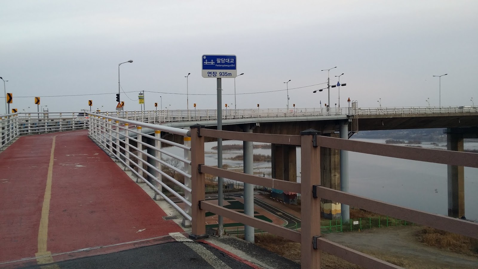
Moving toward Paldang Bridge:

An interesting sight along the way:

The sign points me toward Yangpyeong, so I'm on course:

There's a story here, somewhere:

A wider shot of the abandoned items:

Paldang Bridge, which I had to cross under before I could take the switchback path up to the bridge itself in order to cross it:

Almost past the bridge (underside):

Looking up, I saw the ramp I would eventually be walking on in order to cross the bridge and the Han River:

Another shot of that ramp:

Hanam's bike-education area (which looked all overgrown to me):

About to turn right and double back, walking up the ramp to the bridge:

Turning, turning...

Going up the ramp, now:
The bridge is almost a kilometer long:

As you can see for yourself:

Luckily, there's a walking lane:

In 2017, I got lost on my way to this bridge. It took my lame ass two whole hours to figure out how to cross the damn river. I was angry by the time I did.
This time, there were no problems. Here's a view from the bridge:

On the other side of the Han now:

Angel's wings, but no angel (you're supposed to pose between the wings):

The path is always changing character:

Another shwim-teo for me to photograph:

The road goes ever on and on...

There are weird little bits of civilization along this part of the path—random buildings that seem to be accessible only by bike. But that can't be right; there must be a car/truck access road somewhere. Anyway, everything was closed. It was Sunday. And cold.

A troop of runners passed me by:

First glimpse of a major landmark: Paldang Dam:

Up closer now:

From here, one can't access the dam itself. Instead, one encounters the first of eight or nine tunnels. Back in 2017, on Day 2 of my trans-Korea hike, I found relief inside these tunnels because the bright morning sun was burning my forearms. Thanks to one of Charles's comments, I eventually found a bike shop that sold the biker's sleevelets called toshi in Korean. No more sunburn problem after that.
Tunnel-liciousness:

Each tunnel had its own unique lighting:

Out of the tunnel, looking left, and seeing a traditional residence:

This part of the path felt as if it were all business:

A humble vista:

I always love the creepy trees:

A home in the distance:

The Korean on the circular sign is actually a hangeulized rendering of the French "bonjour." Hangeul is horrible for transcribing French sounds; with a Korean spelling, the graceful "Bonjour" sounds like "bohng-joo-reu."

The dowdy family that greets you with its awkward "Bonjour":

I often chose to walk on the bike path instead of the pedestrian path, usually in the lane with the opposing traffic. Very few bikers came from that direction, so I wasn't worried about getting smooshed: I'd have plenty of time to avoid any oncoming traffic.

An impressively roof-tiled shwim-teo:

Charles's wife Hyunjin apparently does work on the side:

Curving around, now:

A sign for the Neungnae Station certification center. In 2017, this is where I stamped my first travel stamp into my Moleskine. One for the record books.

The cert center itself:

Below—one of the derelict trains still standing on a fragment of railway. This one got converted into a restaurant or something, but it appeared to be closed and quite dead. A few disappointed tourists poked about the train in a dispirited way; nothing happening here.

Rabbits and a cat:

A transparent panel looking down into nothing interesting:

This thing calls itself a shwim-teo. I'm not so sure:

Sure enough: "Dasan Shwim-teo."

Much ground yet to cover:

This gives new meaning to "duty-bound":

En avant vers le futur:

The trail, acting quirky:

Wooden bridge:

Approaching an old, converted rail bridge:

The sign below says, "North Han River Rail Bridge," even though I've turned south and am following the South Han River (Namhan-gang).

About to cross a threshold:


Welcome to Yangpyeong-gun (a gun is like a "county"):

The lead-up to the rail bridge:

Here we go...

Again, these glass fixtures aren't all that scary:

Look at all that rust:

On final approach to Yangsu Station:

A closer look at the station, where I took another restroom break:

And back to the trail:

Life is a highway...

Shinweon Station:

I'm always amused by the Korean obsession with abstract sculpture:

I saw these cutesy residences and decided to take a picture of them. Make them out of adobe, though, and they could pass for boxy little pueblos.

The path is getting harder to walk: my feet hurt at this point, and I've already sat down for a couple of breaks. But I have still a long, long way to go:

I'm approaching the rest stop where, in 2017, I sat and talked to a family and to a policeman-in-training who was biking to Busan from Seoul during a four-day furlough:

That was in the spring, though. The place was closed on this day:

A sign for the rest stop:

I can never take the name of this train station seriously, so here I am below, yukking it up. Guksu is Korean for "noodles." Guksu Station sounds tasty and somewhat frivolous.

Yet another of many straightaways:

I wondered whether this was a single-family domicile:

Ice, ice, baby:

These ice-related pics were taken inside one of the later tunnels. Most of the tunnels had been well made; there was no leakage in them. Some unluckier tunnels, though, were seeping moisture, possibly because of poorly sealed pipes, possibly because of groundwater seeping through imperfect concrete.

A wider shot of the mini-glacier:

Another one, but with stalactites:

And we're out in the world again:

Ah, bridges. Bridges are my life, as you see below. I actually stopped at this locale to use the restroom. Signs indicated that the plumbing had been shut down for the winter months, but this hadn't stopped guys from shitting into the now-unflushable toilets in the men's room. Disgusting. All the toilet bowls in the cubicles were brimming with shit. Luckily, I just needed a stand-up urinal, which I used before I got the fuck out of there.

I once again couldn't resist taking a pic of Satan's own creek:

A somewhat junky area, and a reminder that I was back in "civilization"...

You can barely see it, but there's a dog in this pic. It barked exactly once, in an old and grumpy manner. Then it let me pass. I'm guessing it had given up on life.

These chickens were more vocal than the dog:

It may not look like it, but we're in Yangpyeong City at this point. I have several miles to go, but I'm most of the way done with my 35-kilometer trek:

See what I mean?

I vaguely remembered this part of the path from two years before:

And this bridge:

Another shot:

Bleh. Traffic.

Crossing the bridge meant being by the river again:

A long, placid stretch:

Way up ahead is the old gentleman with the wounded dog that I had blogged about previously. When I caught up with him and talked with him, I was momentarily tempted to ask whether I could take a picture of him and the dog, but the civilized part of my brain shut that impulse down quickly and kept me from making an ass of myself:

An architecturally interesting house on a hill. I had to walk up some stone steps to be level enough with the house to take the following picture:

Something you never see near the big cities: a house with a proper yard:

The path wends onward:

Sometimes, you have to cross that bridge when you come to it:

A church on a hill. After passing the old man and the wounded dog, I wondered whether it might be advisable to go to the church, see whether any signs displayed contact phone numbers, then call somebody, anybody, to come drive over and help the man and the dog somehow. In the end, I decided to leave both sentient beings to whatever fate the gods of the path decided was apropos.

We're moving more explicitly into downtown, now; the path here joined a street:

And there, once again, was the goddamn art museum near which, supposedly, was the certification center that I never found in 2017. I circled that fucking building three times, chasing after the little pip-image on my cell phone, which insisted the certification center was right there. Am I that much of a navigational idiot? Idiot or not, I simply couldn't find the damn cert center.

I was steamed when I realized that my "direct" path to the motel took me past the art museum. I had thought that, by not plotting a course to the cert center this time, I would bypass it entirely and head straight to my lodging. As it turned out, the motel was 1.1 km from the art museum. Fuck. My feet were killing me.
Heading back toward the river for the final part of the walk:

Swinging back out to the river brought me face to face with this commemorative stone:

And the bowling balls favored by Russian bodybuilders:

The stone up close. I'm going to guess it's related to the start of the Korean War, which began on June 25, 1950 and is known as "six-two-five" (yugio) here:

The final stretch stretches before me:

These stairs looked familiar: last time, I had taken a cab from a far-flung part of town to the River House motel. After staying there two nights, I left the motel and realized I was right next to the river and could pick up the bike path from right there. It was the memory of that fact that prompted me to re-plot my course, this time, to avoid the cert center and art museum and just go straight to the motel: I surmised that, instead of heading into downtown, I'd follow the river the entire time instead. Of course, we see how that turned out: I did end up downtown this time, and I didn't really save myself that much time or that many steps.
The stairs going up to the street where my motel would be:

The last bit of sidewalk before the end of Day 2's long, achy trek:

Et voilà: the River House motel:

A closeup shot of the signage:

A view of the Namhan (South Han) River from inside the motel's garage:

I went looking for food after checking in, and I found Hoya Chicken. As a Hoya myself, I was duty-bound to eat this bird:

Before the big reveal:

Tah-dah! I got the chicken poppers (dak-gangjeong). The restaurant cheats and fills your mini-bucket about a third full of fried ddeok (rice cakes) so as to skimp on the chicken. I ended up liking the ddeok better than the cheap-ass cuts of chicken meat, anyway. I've never been so disappointed by a fellow Hoya.

Travel beard and hat head:

No blisters on the left foot:

No blisters on the right foot:

Nighttime view of the river:

And finally, a view of the river the following morning:

On Monday morning, the walk to Yangpyeong Station was under 800 meters, and I'd had a good night's rest, so my feet didn't scream that loudly when I limped out to catch a subway back to Seoul. While this wasn't my usual 120-kilometer walkfest, it was a worthwhile way to spend a weekend. Who knows—I might do this again, especially as the weather begins warming up. Meanwhile, I hope you enjoyed this little photo essay. If you're bored with life and don't know what to do with yourself, get a decent pair of walking shoes and go try walking a few thousand steps. Push that up to a few tens of thousands of steps, and note how the world is never the same even if you end up walking the same route day after day.


Great photos. Enjoyed the walk with you this morning and didn't get tired at all! Made me *almost* miss Korea...
ReplyDeleteYou have discovered HJ's secret. Turns out that SNU profs don't make nearly as much money as "Sky Castle" would have you believe.
ReplyDelete