
[UPDATE: To spare you the pain of having to scroll all the way down past 141 photos just to read my epilogue, I'm inserting an internal link here (jump to epilogue) that will let you click and find yourself instantaneously down at the epilogue's text. Once you're at the bottom, click the internal link there to zip right back up to the top, i.e., here.]
Well... I guess this is it: the final Walk Thoughts post. There's a lot to say about this "make-up" walk, but let's take you through the pictures first. Click on each image to enlarge, then right-click on the enlarged image and hit "view image in new tab" to see the image at full size.
I got to the Express Bus Terminal early enough for the bus not to be there when I arrived.

I was there so early that two other buses came and occupied that spot before my bus to Sangju City finally arrived. Here's a blurry shot of my bus's interior:

When I got to Sangju, I took a taxi to the Sangju Sangpoong Bridge, which is where I needed to start my makeup walk. Here's a shot of the bridge:

Before I got moving with my much-lighter pack, I decided to take a shot of it:

My final "me and my shadow" shot, which makes me look like a one-armed freak:

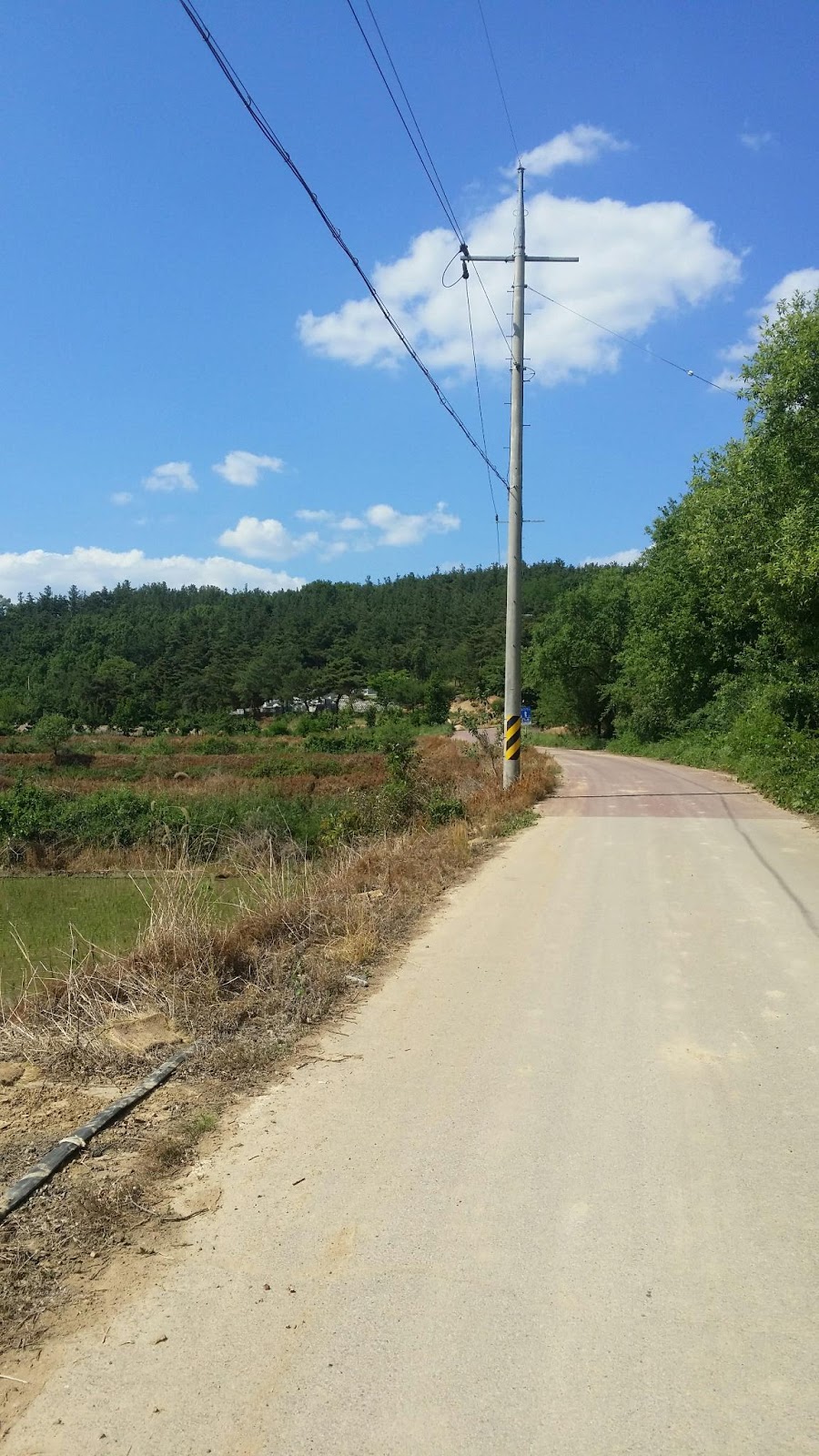
Much of the initial trail—which ended up being a little of everything—looked a lot like what you see below, i.e., long, open stretches with plenty of flowers:

A few kilometers down the trail, I hit my first major hill, the first of several. A few Western bikers passed me, and as I walked, I watched them in the distance, slowly mounting this uphill at a painfully slow pace:

The uphill continues:

And continues:

And continues:

Nice view, though, as I made my way up and up:

Leveling off for a bit:

Then a very nasty, steep uphill:

The view from an observation deck at the top of that hill:

And another shot from the deck:

Yeah! Go home, Yankee muthafucka'! Stop inseminating our women!

Every uphill eventually ends:

I've gone down the other side of the mountain and ended up on some flat land with various touristy spots along the road. See the geodesic dome in the distance (off to the left)? On the right is a restaurant that caters to cyclists.

Here's a closer look at that restaurant:

And a closer look at the old, rusty dome across the street:

Some sort of museum-like property (munhwagwan = cultural center):

And the inevitable shwimteo:

The road goes ever on and on:

More sights to see (Sangju Museum):

And more (a seminar hall):

Definitely not a temple entrance (no lotuses or dragons):

Perhaps a seoweon (Confucian academy)? The stonework makes me think that that's not a good guess. I'm great at recognizing temples, but not so good at identifying other types of older Korean architecture, which can often look similar to temples. Whatever building or campus this is, it's obviously been restored. Wooden structures need constant rebuilding (due to fire, rot, etc.), but even stonework needs to be replaced now and again.

How can I pass up Grave of Loyal Cow?

I fear I'll just have to imagine the cow itself:

The threshold for Gyeongcheondae:

The local bus stop, if you're GPSing my location:

The bike trail turned left into this park-like area, which turned out to be a large property on which could be found public restrooms, restaurants, picnic areas, campgrounds, and even a sculpture garden, in which I spent some time madly photographing everything I could before time pressure forced me to continue onward. Let me just say that I find most sculpture gardens calming and therapeutic, and I don't know why I don't seek them out more often. Anyway, here's the initial uphill:

A manmade waterfall:

The sign for the campground is interesting here. It says yayeong (camping) and glaemping ("glamping," a portmanteau of "glamour" and "camping," i.e., spending the night in these huge, well-appointed tents with all the comforts of a hotel room). Later in this series of pics, I have some shots of a glamping site.

A larger-than-usual group of tap, which can mean "pagoda" or these little, delicately stacked cairns that you can often find in the mountains as sort of the Eastern version of Western mountain cairns built by hikers and/or ancients:

I'll change this caption when I've researched the Chinese characters.
UPDATE: these are the characters gyeong cheon dae, the name for this region. Gyeong might mean "field"; cheon definitely means "sky"; dae means twelve different things; at a guess, it's a signifier for a place:

Stairs with more cairns:

A map of the area:

...and now we reach the sculpture garden, where I could have remained all day. It was filled with large wooden sculptures that called to mind both jangseung and various Buddhist works of art, as well as Western Catholicism because many of the figures are shown wearing robes held together at the waist by ropes in a manner reminiscent of Franciscan attire. First pic:

The trail goes thataway:

I have a photo of this sculpture's name/title in a later shot:

The sculpture garden is called Isaek Sculpture Garden. I think the term isaek means "unusual" or "out of the ordinary." I had to wonder whether it meant "differently colored," given that there's a Chinese character pronounced "ee" that means "different," and the word saek means "color." This is an information-pamphlet holder:

The name/title of the previously photographed sculpture is shown below. The Korean at the top says bok, which means "happiness" or "good fortune." But the Chinese in parentheses says o bok, which refers to the Five Happinesses in Chinese thinking: longevity, wealth, health, virtue in life, and a peaceful death.

Below: Franciscan monk meets Easter Island head. I'll have to get back to you as to what these Chinese characters mean. I've already tried searching for the first character, and I keep coming up empty. The second character is neung, which means "endure." That fits the Korean, which says Chamara, a command to be patient. It could be that the first character also means "endure." Chinese expressions, at least as used by Koreans, are often pleonastic.

Below: the Korean shows bun-no, which means "fury." The Chinese characters also both mean "anger," so I'm guessing this is another pleonastic expression.

Below: I think inyeon here refers to fate or destiny.

This sculpture of hyushik represents the concept of rest:

Some old-style Korean dwellings (I think... unless they were storerooms):

The title for the following sculpture is in pure Korean: man-nam means "meeting," which is pretty much what you see happening.

Next comes ggoom, i.e., "dream":

This is manjok ("satisfaction"):

Here's a closer shot of manjok. As you see, people have tried to, uh, feed the statue to keep it satisfied. The effect is simultaneously amusing and creepy.

Another shwimteo, done up classically:

The sculpture below is deuk, which apparently can mean something like "profit" or "obtaining (what you want)." In fact, the Chinese character has many meanings.

This is nanum, i.e., sharing:

A sign for Sangju Dam and Nakdan Dam, indicating I'm going in the right direction. The bike path meandered through the sculpture garden, but it eventually swung back to the river.

And here, folks, is a photo to show you what "glamping" entails. If campgrounds are camping for the timid, then glamping is camping for outright pussies:

And now we descend:

The character of the path is always changing:

A bridge with interesting, cycling-themed metalwork:

A closer look:

All this complicated arrow crap just to tell me to keep going straight. One arrow is pointing toward Andong Dam, which is located off a spur of the trail, miles and miles away. I never went that way, so I never saw the dam.

A very interesting notion of how to camp. In 2008, I did something similar with my tarp, using it to provide shade over my tent. A parasol for me would have been funkier:

A few kilometers later, and I'm face to face with the god of all mallards:

ALL BOW DOWN.

Were I a kid, I might find this sort of dwelling amusing. As an adult, I just find it lame and sad and a bit creepy.

But, wait: there are more such buildings. Joy.

God help us all.

That's enough duck ass to last me a lifetime, methinks.

I think this tableau is meant to be a touching scene of a mother and her baby. To me, this is more like a Stephen King nightmare.

More munchkin hovels:

Here's some hope that I'll reach the Sangju Dam and have a timely lunch:

A bridge that leads to a large island in the middle of the Nakdong River:

A performance space, ready for action:

The island is called Gyeongcheon:

One of the weirdest-looking public restrooms I've ever seen:

Moving on...

I saw the mountain, and it looked ripe for photographing:

Looking back at the bridge to Gyeongcheon Island:

This stone marker was on the property of what I'm almost positive is a proper seoweon, i.e., a Confucian academy. In fact, I think the Chinese reads Donam Seoweon. The word do means "Tao," and nam means "south," but I'm not sure how best to translate "Donam" into English. South Way? South of the Way? (Tao simply meant "road" or "way" or "course" before it acquired its philosophical meaning.)

A better shot of the seoweon:

And an even better shot:

The Chinese characters here need to be read from right to left: In Deok Mun, the door (or gate) of personal virtue (person-virtue-door). Apropos, given the purpose of a Confucian academy: to cultivate the whole person. This comes from a time when education actually meant something because it had intrinsic value and wasn't seen merely as a means to getting a decent, secure job later in life. But I'll save my ranting for later.

I need to go character by character down the line to figure out what this stone marker is all about. In the meantime, just bask in its obvious importance.

For the GPS crowd, another bus-stop picture, but my main interest is the image of the island (Gyeongcheon Island), which you see in an aerial view here:

And here's a closer look. Interesting island:

One kilometer to Sangju Dam's certification center and the acquisition of my missing stamp! Alas, I'd forgotten to bring along my Moleskine, so I figured I'd stamp my tiny spiral notebook, then tape the stamp to the inside of my Moleskine.

The dam from a distance:

A bikers-and-walkers-only passage across the dam:

I leaned out to take this shot of falling water, fearing the entire time that I was going to lose the grip on my phone and watch impotently as it plunged into the river. Luckily, that didn't happen, and I got two shots this way. The first:

The second:

Along the rivers I walked over the past month, there is definitely a Cult of the Bicycle. Notice the bike image etched into the side of the tower?

And again:

Here's the cert center:

And here's my stamp, which I stamped onto a white sheet of paper inside the booth. I ripped the paper off the clipboard, then tucked it into my spiral notebook. I also got a stamp for the notebook (to keep it from feeling envious). Dated and everything:

And here's the stamp in my notebook:

I sat down to an MRE for lunch. MREs are a pain to carry if you must carry several of them, but since I had only a single MRE on Saturday, my backpack was light, and there was no problem. This MRE was particularly good, being chicken pesto pasta. Alas, the packet of cheese didn't match the Italian-flavored breadsticks, but a man does what he can to adapt:

Chicken pesto pasta, heating:

An oh-so-appetizing glimpse into the depths of my food pouch:

Once again, evidence of Koreans' love of abstract sculpture:

Lunch is done. The path changes character yet again:

A backwards-looking shot of the dam:

And we're back to long, open stretches:

Rice paddies were everywhere along this section. If Seoul and Busan are the equivalents of the US east and west coasts, then my walk took me all the way through the Korean equivalent of "flyover country," i.e., Trumpland. This is where people really work for a living.

A low bridge in the distance:

Lane markings:

The path changes color and texture again:

An archery range in the distance:

A snakey road:

A causeway is technically a raised roadway leading over water or wet land (e.g., a swamp). This road, leading me above and between flooded rice paddies, felt like a causeway.

The mountain's reflection in the paddy was impressive:

Uphill. Again.
Thank you, sign, for telling me what I already know.

Another important-looking rock:

Waaaaay uphill now:

Downhill and into another small town for a bit:

But here be bovines!

A silent, sad crowd. Not a single moo.

And—surprise, surprise!—yet another hill!

I stopped at this shwimteo, rested, checked how much distance I had yet to walk, texted the cabbie I had retained, drank most of my water, then slogged onward.

And up we go...

I'd have liked to stand in the spray for an hour, but I had electronic equipment on me, so that was a negatory. Then again, that spray could have been pumped straight from the river...

At this point, I'm just about to embark upon the most dangerous part of the walk: crossing the Joongdong Bridge, which had no bike/pedestrian lanes. I had to stop many, many times during the crossing to allow cars to pass me. Not my happiest moment.

A clearer shot of the bridge in question:

Ladies in the field (closeup):

Ladies in the field (wide shot):

Another long stretch:

Lots of paddies, but no Irishmen:

Campers out by the river's edge. Where were you guys two weeks ago, when the weather wasn't as hot and humid? Idiots.

Another classic shwimteo.

A map with lying numbers (about distance):

By this point, I was getting confused as to why, with only a few kilometers left in my walk, I hadn't seen anything I remembered. Last time around, I walked five miles (about 8 km) from the second guest house to the Nakdan Dam. It was during that walk that I met the puppy... but up to this point during Saturday's walk, I hadn't seen any territory that I recognized. Had my first walk been a completely different route? What was going on, here? This tall bridge didn't look familiar, and I think I had perhaps four kilometers to go. I was beginning to worry that I'd never see the puppy.

Another shot of the unfamiliar bridge:

The afternoon was getting darker and cooler, which brought out clouds of gnats. The gnats were swarming randomly, though, so I didn't have to worry about being chased by gnat-clouds. I simply kept walking, and the bugs fell behind.

Now this began to look familiar. Another uphill—one of the last ones:

And there he was! My little buddy!

As before, there was the pup, and there was this tiny, much older dog that yapped and yapped at me. I had come prepared this time: when the puppy came up to me, I brought out my small bag of very expensive jerky and began feeding pieces to the dog, bit by bit.
How can you not love that face?

The dog was quick. He snarfed up the beef so fast that it was impossible for me to catch him in mid-bite. The shot below was taken a millisecond after the dog had gobbled a piece of jerky that I had tossed to the ground to give myself time to get a photo of dog-plus-food.

Here, at last, I happened on a good tactic: I dangled the jerky over the dog, which made him hesitate just long enough for me to snap a pic.

I got this awkward shot while petting the puppy. I guess I stretched the skin on his face, which is why one of his eyes looks so freakish:

The puppy was constantly moving out of frame, and when he was in frame, he'd often be looking away, so I'd have to say "Hey!" (or "Ya!"—the Korean equivalent) to get him to focus on me and my camera.

I hadn't noticed these jangseung during my previous walk through this section, so I took the opportunity to rectify that oversight:

Not sure why I split the dog in half in this photo:

Cute from all angles:

I even got an ass shot for you pervs:
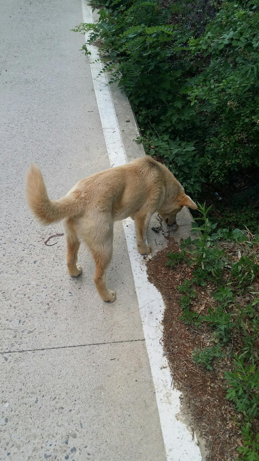
The puppy, now well fed thanks to my bag of treats, followed me farther down the path this time. He really needs to be trained in how to take food from a human hand: he kept biting my fingers in his eagerness to get at the jerky. Here's a final shot of my buddy:

The rest of the walk was exactly as before, so I saw little reason to re-take the same pics I had taken previously. I did, however, want to close with this one last image of the Nakdan Dam:

Epilogue (back to top)
As Jesus said on the cross in the gospel of John: It is accomplished. I can now claim, without lying, to have walked every damn inch of this country from my apartment in Seoul to land's end in Busan. I haven't just walked the distance: I've walked the entire way.
It shouldn't have had to be this way, of course: had I not encountered that snag in Sangju City, with the scatterbrained guest-house lady and the second guest house from hell, I wouldn't have had to take an extra Saturday to make this part of the walk up. But be that as it may, the walk is now done.
The 18-mile trek from Sangju to the Nakdan Dam turned out to be one of the most interesting stretches of the whole trip. It included a variety of terrain ranging from flat, wide-open spaces to a few challenging hills (including one hill with a nasty 18% grade—which doesn't sound steep but which is, in fact, pretty damn steep, even for a walker). The weather was hot but lovely the entire time; I often walked in shade and even benefited from the occasional river breeze. My feet, having been pampered for a whole week after I finished the Gukto Jongju on May 17, were aching by the end of Saturday's walk, and I think I've ended up with another blister on my right foot. It's not serious, being a mere white spot next to the ball of my foot, but the pain is a bit annoying. I trust that it'll be gone in a few days.
There were moments during the walk in which I was chugging along at 3.3 miles per hour—somewhat faster than my usual leisurely 3.0-mph pace. As for my pedometer stats:
approx. 420 minutes
43,077 steps walked
22.25 miles
3238 calories burned (2465 net)
Not a bad day of hiking, all in all. It was fun to be back out on the trail again after a week-long rest, but it was also sad to know that this trek was merely a one-off makeup walk, and that my Seoul-to-Busan project was now truly over. I went through a slew of mixed feelings as I walked, but the one feeling I hadn't expected to experience was anger. Allow me to explain.
Every good epilogue to a story should perform some special function. It should add an interesting wrinkle to the plot (e.g., the epilogues at the end of the third and fifth novels in the A Song of Ice and Fire series), or tie together some loose ends. My epilogue does both. To wit: I was barely three kilometers into my walk when a female biker hallooed me from behind. When she pulled up to me and stopped, her biking mask still on her face, she said, "Guest house!" and I immediately knew who she was: my least-favorite ajumma from this entire trip. Yes: this was the scatterbrained guest-house manager herself, out for a ride, and when I realized who she was, my mood immediately soured.
"What are you doing here on the trail?" she asked.
"I made it to Busan last week," I replied, "but I had to make this part of the trail up because I couldn't do it, thanks to you."
"I'm really sorry about that," she said, echoing the same sentiment she'd expressed on the day she canceled my reservation and sent me off to that second, hellish guest house. I wasn't in the mood for her faux apology.
"You know, I had made a reservation with you," I grated. "I had a right to stay at your place, but you threw me out. I was very angry that day."
The ajumma once again started in about how she had lacked a Western bed, and I cut her off. "I told you several times that I was fine sleeping on the floor," I snapped. I could have said more: I could have said that, thanks to her, I'll be shunning anything labeled "guest house" in Korea from now on. And thanks to her and her chunky, pushy friend at the second guest house, two out of three of my guest-house experiences along the trail had been horrible. I could have said that, after I had been trucked over to that second guest house on a day in which I had walked thirty kilometers, I was forced to wait until 10PM that night to get a room, and when I finally got one, it was a minbak-style bedroom in the house of a weird family. I could also have said that the bedroom's ondol floor was uncomfortably hot that night and the entire next day that I was there, and that the house's ajeossi barged into my room at inappropriate times instead of just letting me rest peacefully. I could have ranted a lot more, but I left things off there, making it clear that I blamed the ajumma for having ruined what should have been a restful end to a good day's walking. Part of me took grim satisfaction in having the opportunity to vent my spleen at this ajumma, who had done so much to ruin that part of my trip. She had probably thought she was doing me a kindness by sending me off to another guest house, but in the end, I ended up sleeping on the floor, anyway—on a floor that was too hot to be comfortable. Never again.
There wasn't much more to say after that. Without offering a proper, formal end to the conversation, I turned and started walking again. The ajumma lamely said, "Have a nice day," got on her bike, and sped off as I gave her a barely audible grunt in response. I should have told her never to cancel foreigners' reservations at her place in the future. The best I can do now, Dear Reader, is to warn you away from this lady's pied-à-terre, the Sangpoong-gyo Hanok Guest House, 300 meters away from the Sangju Sangpoong Bridge. Keep well away.
Things got better after that, but the day wasn't done with its surprises. The next surprise had to do with the milestones: early in my walk, I marched past a milestone saying that the Nakdong River estuary was 278 kilometers away, which seemed about right for that point along the trail. About two or three hours later, I walked past a milestone saying the estuary was 300 kilometers away. I did a mental double-take, suddenly wondering whether I had been walking backward, Twilight Zone-like, all this time. By the time I was done with my route, I think the milestones were saying that I was some 280 kilometers away. Someone needs to recount the kilometers and re-number those damn milestones, none of which I ever fully trusted. About the only distance measurements I trusted came from Naver Map on my cell phone, and I wasn't sure I trusted those measurements, either.
I've written above about how the walk concluded. I was unsure whether I'd see that cute little puppy again, but luckily, I did. The final two kilometers of the walk were smooth, beginning with a downhill slope from the puppy's gulch-y neighborhood and concluding with a nice walk across the Nakdan Dam to the certification center and my waiting taxi. The ride to Sangju City was quiet and beautiful as I watched the countryside roll by.
The bus I took back to Seoul from Sangju went to East Seoul Terminal (Dong Seoul Jonghap Teomineol); I took a cab from the terminal to my apartment. The cabbie humorously remarked that he knew I'd had a workout because he could smell me. I apologized for my reek; he laughed it off and said not to worry about it, but the social damage was already done. Koreans normally have no filter when they talk to you: they say pretty much whatever pops into their heads. One way to look at that trait is to say they're honest, sincere, no-bullshit people. Another spin is to say they're boorish, uncultured assholes who can't control their mouths. Take your pick. My own pick varies according to my mood.
So now it's done. I've finally covered every inch of the path from Seoul to Busan. Having already provided, in previous posts, plenty of ruminations on the deeper issues and themes of this walk, I'll end by offering some advice to prospective walkers of the Gukto Jongju route.
1. Know that "the Gukto Jongju" isn't a single path, but a network of paths all tending in a particular direction. Taken together, these paths will get you from Seoul (or even Incheon) to Busan. Sometimes, when a mountain is in your way, the path will split, and you'll have to choose which way you'll take to skirt the mountain. One way will undoubtedly be longer and more difficult; this is the time to consult Naver Map on your phone to check distances and contour lines (remember that Naver Map does, in fact, show contour lines, which is extremely useful, albeit occasionally misleading).
2. If my experience is any guide, expect to camp for only three days of your walk. Depending on how you schedule walks and map out your distances, it may be possible to reduce that number to only one or two days' camping. With good planning, you could, in theory, walk most of the Seoul-Busan path largely unencumbered, secure in the knowledge that some sort of food and lodging can be found at almost every stop along the way. Convenience stores and restaurants tend to be in the vicinity of motels, so resupplying should never be an issue. With that same good planning, you could pick up your camping gear about two-thirds of the way through the walk, use the gear on the days needed, then drop the gear off at a post office and send it home via taekbae (courier delivery).
3. Avoid doing something stupid like hiking during the monsoon season. I was extremely lucky, I think, to experience as little rain as I did despite hiking in April. If I tried the same hike at the same time of year in 2018, I doubt the weather would be quite so accommodating. That said, mid-spring is the perfect time, temperature-wise, for a cross-country hike. It's late May now, and Saturday's hike was a reminder that summer heat can be a killer. The weather wasn't as hot and humid as it gets in July and August, but I could feel the imminent arrival of full-on summer. I had originally planned to start hiking in May, with the hike possibly spilling over into June. It was my boss who insisted that I take my vacation a few weeks earlier for reasons related to our company's publishing schedule, and at first I resented having my plans countermanded. It turned out that the boss had, perhaps inadvertently, picked the perfect time of year for me to engage in a cross-country endeavor. Korean spring is beautiful; don't waste your time hiking in the summer or winter.
4. Some will deride what I did as a form of "credit-card tourism," given that I motelled my way across most of the country. "A real man would have camped every night!" such people will declare. Maybe so, but then my pack would have weighed 60-70 pounds because it would have been laden with food for the entire trip. That, in turn, would have translated into serious back and foot problems. To my mind, the "real man" would be stupid not to take advantage of the fact that civilization is almost everywhere along the path. Don't make this trip into some dumb survival game; just enjoy the sights, learn something about the land and the people, and don't waste your life making things unnecessarily difficult for yourself.
5. On that note: take it easy. Despite the blistering, the aches, and all the other pains, I did what I could not to push myself to the point of blind fatigue. On some days, this wasn't possible, but I did manage to avoid injuring myself the way I did in 2008. Remember that you're doing the walk to have an enjoyable experience and to make good memories, not to engage in self-torture. Go slowly. Smell the roses. Drink it all in.
And that, I think, is all I have to say about this amazing walk that I took. It's finally over, and I can finally close this chapter of my life and move on. The weight I lost has caused one funny thing to happen: when I cinch my big leather belt to that final hole, the front end of the belt now wraps halfway again around my body. That's right: my belt circles my body 1.5 times! And I'm still fat, with about 30 kg of extra blubber to lose! Imagine what would happen were I to shed even more weight. Can we go for 2.0?
Thanks for reading along and commenting, folks. It's been quite a trip, hasn't it.
Walk on!


10 comments:
Once again I really enjoyed your trip report and photos. I'm not seeing much humanity in the area, yet the infrastructure seems built for crowds. But if no one was out and about on a Saturday...?
The mallard head was pretty cool. Although the bill seemed awful close to the ground. I hope you didn't forget to (ahem) duck...
John,
That's a good point re: humanity/crowds. I'm guessing that the area will liven up during the full summer months.
franciscan monk pic. the characters read 인내 patience
Thanks, Hahna!
thank you for posting up pics of your walk. it's nice to see korea like this! and also i am so glad you met the pup again. super cute
Congrats on finishing your walk. I don't know if you've seen this man's walk around Australia in a Stormtrooper suit, but I think his not having a backpack to lug around is a great idea. Losing 1/3 of his body weight while in the middle of nowhere out in the bush, not so great.
I must admit that I haven't gotten through all the pictures yet, but a few comments on Chinese characters:
The 경(擎) in 경천대 means "to lift up" or "to rise up" (들 in this case is a verb, not a noun). 대(臺) is indeed a place signifier, and it is generally used to refer to a high place. So a possible translation would be "High place where the sky soars".
As far as 이색 goes, the literal meaning of the word generally translated as "unusual" or "out of the ordinary" is indeed "differently colored." So they are the same term, not two different words. It's just that one meaning is literal and the other is metaphorical.
I'm not sure about Donam Seowon, but seowon are usually named after people, so it's likely that "Donam" is a name.
Thanks, Charles. It's a lot of pics to get through, so please take your time.
OK, got through all the pics, and read the epilogue, too. Glad to hear that you met your little friend again, even if he did try to snap your fingers off. It's funny to hear that you met the 민박 ajumma again as well. Sort of a perverse bookend to the trip.
I hadn't realized you had missed that much of the trail. I was thinking that it was only a little bit, but apparently it wasn't! I can see why you felt the need to see it through.
Agreed on the camping front; why would you want to camp if you didn't have to? Not that I don't like camping, but going someplace to camp and enjoy yourself is one thing--camping on the trail when you have to lug everything around yourself is another thing entirely.
Charles,
It was a nice, healthy 18-mile chunk that I missed. I suppose I could have cheated and walked only 13 of the 18 miles, given that I did manage to walk 5 miles on the day in question. But as I discovered, almost 4 of those 5 miles were an utterly different route, so it's good that I covered the missing segment from end to end in a proper way, from Sangju to Nakdan.
Post a Comment