So, Saturday afternoon, I went out with JW to the Hantan River. JW had found a park right next to the Sky Bridge that I had mentioned in an earlier post. He swung by my place in his car and picked me up around 5 p.m., and we arrived at our destination at a little after 6:30 p.m. As I feared, JW hadn't really thought through this plan, and also as I'd feared, the trail we ended up walking proved to be hard, sweaty, and borderline dangerous for stroke victims with balance issues on stairs, both up and down. We ended up walking no more than 1.5 hours, and when we hit an actual road that seemed to be part of the trail, we eventually gave up and turned back to the parking lot, with JW declaring the day a failure. Somewhat depressed, he kicked himself for not planning out the day.
Now unlike JW, who rubbed it in after my stroke by saying a rather uncompassionate "I told you so" to me, I didn't rub it in with him, despite my fears going into this that it was going to be a shit-show. I mean, one look at the spread of photos on Google was enough to set off alarm bells about the Hantan River trail. I could see right away that the photos all showed landscapes, but they didn't show the trail itself. This was enough to make me think the trail wouldn't be flat like most bike trails. The other indicator about the terrain was the presence of those bridges. They were beautiful (and we ended up crossing the Sky Bridge), but the fact that the bridges were so high up meant that, if the trail dipped down to the level of the river, there would be a lot of ups and downs. When I expressed this fear to JW while we were driving to the site, he dismissed my fear by declaring, "No, it's not like that." Well, it turned out to be very much like that. Also, JW had originally wanted to meet at 1 p.m., but he belatedly realized how hot the day was going to be, so he delayed our meet-up until 5 p.m., thus allowing us to start hiking when the sun was down at a low angle.
As I said above, the hike itself was harsh and miserable. It was a McCrareyish hike if ever there was one—a real Korean trail, rugged and hilly, and not the milquetoast stuff I'm used to. I took photos along the way, and I made sure to show the path itself along with some landscape shots. You'll see the pics below. I'll give JW credit, though, with making some wise command decisions during the hike, including the decision to call it quits and turn back. The trail we initially followed went through the woods for about a kilometer, during which time we encountered three or four steep hills with steps cut into them. Eventually, though, we came to a clearing and had the option of following the trail along a paved road, which we did with relief, both of us sweating buckets. (We were assaulted by flying insects the entire time as well—an unpleasant combination of flies and mosquitoes.)
JW spent a lot of time berating himself about what he saw as a major failure. I didn't need to spell out for him that lack of planning was the cause of our problems; he figured this out on his own, and as I said, I didn't rub it in. In fact, I told him the experience of the difficult trail had been educational, and that he shouldn't beat himself up about it. I also explained my usual method for plotting a route: first chart it on Naver Maps and take a look at the contour lines to get an idea of what the terrain's going to be like, then walk the route myself to see whether it'll be worthwhile to do with a partner.
So the day had been something of a shit-show, but it had also been educational (I don't think I'll try tackling this trail in the summer ever again, but the fall might work, assuming I'm in better physical condition to tackle such a rough trail). I also learned (well, I had my suspicions confirmed) that just because a trail is by a river doesn't mean it's going to be level, like most of the bike trails I know.
We drove back to my place (JW joked it had been more of a driving day than a walking day), and once I got out of the car and bid adieu to JW, I walked some neighborhood creekside paths (the Yangjae and Tan Creeks) for two hours to get my steps in for the day, from roughly 9:50 to 11:50 p.m. 3.5 hours of walking is less than I had expected to do on Saturday, but that's roughly the time and distance for a typical Bundang walk, so the extra two hours at the end were enough, as far as I was concerned.
Right, so here are a slew of pictures taken during the walk, which started optimistically enough before descending into nightmare territory. We began in an ecological park:
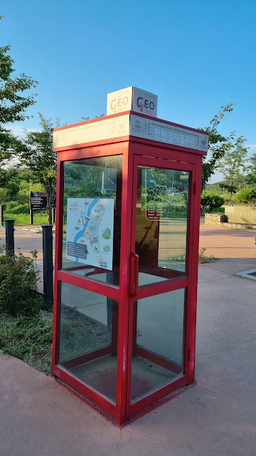
It called itself a "geopark":
The park walk was placid enough:
Everything seems well manicured:
We were excited to see an indication for an overlook to view some falls:
JW suggested I take a photo of this map, which we didn't use to navigate:
A familiar sight: a certification booth such as you'd see on the Four Rivers trail:
More signage:
An exhibit about the geological features of the riverbed:
The falls, which were small and disappointing:
But there was a nice vista, which was also worrying for what it implied about terrain:
A slightly different angle:
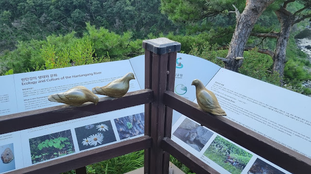
Bird sculptures:
Another grand view from the observation deck for the falls:
The beginning part of the trail that would lead us into misery:
We're working our way toward Sky Bridge:
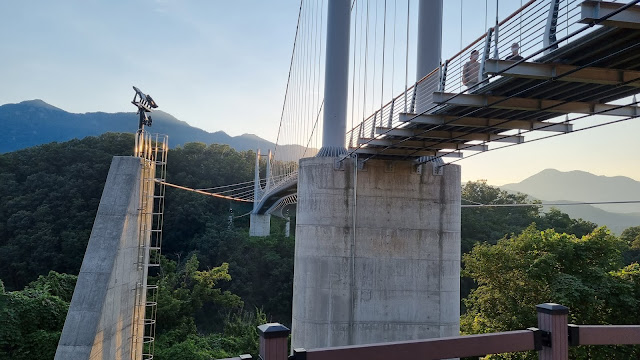
Sky Bridge, first look:
More maps along the way:
The path up to the bridge was a spiral:
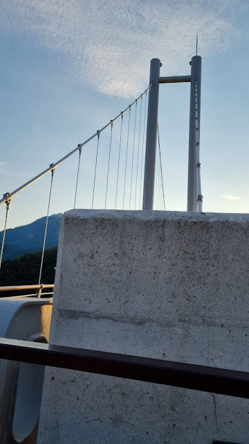
With the sun in the west, getting a bridge shot from this angle was hard:
Sky Bridge, Pocheon Hantan River:
Again doing what I can to block out the sun and get the shot:
The bridge had clear glass sections to let you see the drop:
A backwards look at the bridge after crossing most of it:
Below: JW almost all the way across. I discovered that the bridge's shaking (it's designed to shake a bit under the weight of people's steps) petrified my friend. He was a mess as we crossed the bridge, constantly talking about how he didn't like the shaking, and how he didn't trust the bridge's designers. I told him he could close his eyes and put his hands on my back, but JW braved the crossing unaided.
A view of the Hantan from the bridge:
Another backwards look:
A map on the other side:
Decisions, decisions. We chose... and it cost us:
If the trail goes down, then (1) you know it's going to have to go up again at some point, and (2) if we were to turn around, we'd eventually have to go back up the way we descended. Luckily, neither of these things happened. You'll see why in a moment:
More hilliness:
Almost the same shot:
And here's the first of several hells. I had trouble, without my trekking pole, making it up these stairs, and we ended up going up several sets of stairs like this, all within the first kilometer or two of the trail:
A rare level spot:
Up a tiny, steep hill, right before we reached a paved roadway:
We had the choice to continue left along something that looked like a trail (or someone's private property), or to turn toward the road and mosey on from there. We chose the latter, which was probably a good thing because as JW noted later, it would have been bad to be caught in the woods when it got dark (so, John Mac, you were right to worry about lighting; there was none in the wooded part of the trail we had done). JW elected to go left along the road, away from where we'd parked the car:
Roadway now:
Some sort of farm-experience event was being aggressively advertised along this road. Signs like the one shown below were everywhere:
Sky Village, it says:
Walking this section felt a bit like walking the Saejae path on the Four Rivers trail:
A shot down the road:
The experience of walking through a rural neighborhood is never complete unless you face a barking farm dog, which we did. Luckily, it was chained up:
A wider shot:
We didn't walk far down the road before JW decided we should turn around and go back to the car. I had made some remark about how the downhill we were on would be a long uphill on the way back, and he may have found the remark discouraging enough to influence his decision to turn around. I don't know. Anyway, we turned around, passed the farm dog again, then crossed a bridge, which is when I took the following picture:
JW on the bridge:
Another shot of the river from the other side of the bridge. There were very few cars, so we had the bridge mostly to ourselves. Behold:
Almost the same shot. My finger may have stuttered on my phone camera:
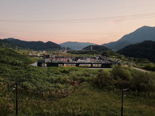
A military-style paintball range (the Hantan is near the DMZ):
Same range, different sky:
JW marveled at the evening sky and bade me take this pic:
A look down the road as we headed back to the parking lot:
Another evening-sky shot:
JW insisted on a closeup of the clouds, which is how I learned how to do the "zoom" feature on my camera. I hadn't figured that out until JW showed me how to place two fingers on the screen and spread them to zoom:
And the above photo is the last one from our walk. It rapidly got dark after that, and we drove home. As I said above, I got out of the car and went for a two-hour walk in my neighborhood to get the rest of my steps in, and since it seemed there was a full moon out, I tried to get some shots of it. I was more successful with this cell phone than with my previous one. Here are two shots, and that's how I'll finish this photo essay:
So the day was a bit of a disaster, but not horrible, all in all—just very tiring for those painful 90 minutes. I enjoyed the Sky Bridge even if JW didn't, and while I'm not sure I'll be back this way again, I'll chalk this Saturday up to a learning experience for both me and JW.











Sorry the walk didn't turn out the way you hoped, but I did enjoy the photos. I really miss Korea sometimes, and it is the organized/manicured trails and first-world infrastructure that I miss the most. Nothing like that in these parts. I'm kind of like JW when it comes to bridges--I don't like them swaying when I cross. The glass bottom was a nice touch though, especially because you had the option to NOT walk on the glass. I walked on glass over the Grand Canyon once and it was a freaky feeling.
ReplyDeleteAnyway, it wouldn't be an adventure if things always went according to plan, or in this case, unplanned. But the scenery was fantastic and you saw something new, so there's that. But dude, why didn't you bring your trekking pole? I carry mine if there is any chance at all I'm going off payment or up and down hills. Glad you made it safely!
"McCrareyish"--I love it!
I didn't bring the trekking pole because, foolishly, I trusted JW's assurances about the nature of the trail, despite my suspicions. Never again.
ReplyDeleteGlad to hear you survived, even if the walk was not everything you hoped for. The pics looked nice, at least. If nothing else, the air has been clean and the skies have been brilliant these days, with some great sunsets.
ReplyDeleteCharles,
ReplyDeleteClean, for sure, except for the damn bugs. As we got closer to the parking lot, though, the bugs went away.